With a work schedule that’s not letting me get any boating in, I’ve been pouring over my back-log of photos and video and realized that there was one run that I haven’t posted anywhere. The Grand Canyon of the Elwha, otherwise known as the crown jewel of the Olympic Peninsula. I was able to get into this slice of Heaven back in the Fall of 2010 with a sick crew consisting of Scott Waidelich, Joe Howard, Bryan Fletcher and myself.
Wow.

"Wow" just about sums up that run in the most complete way I can think of. It’s that gut feeling of overwhelming satisfaction. The feeling that you get after you stomp a huge fluffy boof or stick that dicey line that you weren’t too sure about in the first place. That rosy glow you can feel in your stomach and chest that makes you smile to yourself. That feeling accurately describes this run as a whole.
Gary Korb; the legend of the Olympic Peninsula described it as such:
“This run is so special it goes beyond words. The white water…the canyons…the wildlife..the riverside camping… it’s the Elwha! It has canyons so beautiful yet dangerous that it gives you a sacred almost forbidden feeling.”
--Gary Korb in “A paddlers Guide to the Olympic Peninsula”

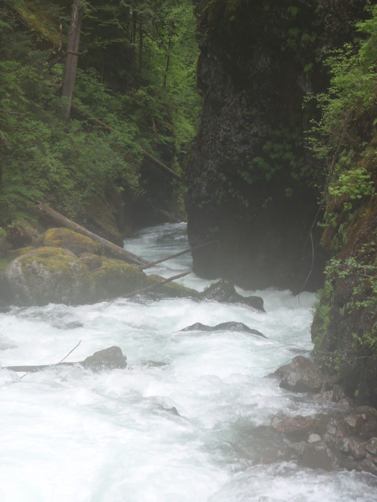
The Grand Canyon of the Elwha is beautiful beyond description. Everything about the trip is beautiful. The 8.5 mile hike to the put in is difficult but gorgeous, the canyons are the most remote and isolated places I have ever visited. By contrast, they make the canyon walls in the Carbon River look scalable.

At times, while scouting, it feels like the canyon opens up around you and closes up near the top, focusing your point of view downstream at the impending rapid or horizon line. The entire scene focuses your eyes and mind on the prize. Other than rock formations, there is little to look at down at river level, as the sides of the canyon walls are so steep in most places that there is a distinct lack of vegetation. This lack of foliage, dark secrets and thrashing whitewater give the river and the canyon itself a very primal and violent feel. But it’s a beautiful scene at the same time.


There’s no beating around the bush: the hike is a beater. You know you’re about half way when you cross a pretty large stream that looks like you could dip a creekboat in it. Then its back to uphill forced marching. Somewhere near Lillian creek there is a spot you can bushwhack through to get an aerial view of Nightmare; the unscoutable, unportageable class V rapid in the first canyon. We had no idea where this trail was so we just pushed through with thoughts of a couple beers and warm food at the put in.

We traveled in two groups and Scott and I were able to get to the putin a little ahead of Brian and Joe. We immediately ditched the boats and set up shop. We were each able to throw a couple beers into our boats at the beginning of the hike and neither of us had tossed them to save weight. Life was good
You get to camp right at the put in for the run, next to a broad, flat stretch of the river that looks nothing like the pictures you see online while searching for computer beta. Its calm, its serene, is quiet. There are no humans for miles and miles.


Then morning brought us stiff backs and not enough food for breakfast. But the sun was out and my nerves where frayed. We packed out boats and set off. You quickly come to some bebop, that helps loosen the shoulders for what’s to come. My GoPro died the night before the trip and my camera stayed in my boat for the majority of the trip so I will leave most of the rapid descriptions until I can get back in there and get some photos of the Shrine that is Elwha.

Eskimo Pie is the first rapid of consequence you come to. There’s no way to portage, but you can scout all you like. It’s essentially a broken shelf creating an almost river wide hole and then a chute with lateral waves and holes in the run out. It’ll get your heart going.


Nightmare is not far downstream. Just a couple of rapids and one portage and then you’re sitting in an eddy looking into a canyon that belongs in the Shire. You can see a horizon line and a big boulder in the rightish side of the channel. Scott was the only one of us that had been into the GCE before and his beta was: “We have to run it, can’t scout it, can’t portage it. Half the river goes into a sieve on the right and the other half gets wild. Don’t go right.”
We had some hairy moments; Scott lead and I followed a couple heartbeats behind, coming around the corner and first horizon line to see Scotty pasted up against and old growth tree the size of a school bus with no paddle. His paddle had snapped in half almost immediately upon entering the first ledge in the rapid. The rest of us made it through without incident.


Rica Canyon is the name for the second half of the trip. When you leave the first canyon you come out into a wide open riverbed with copious amounts of sunshine and wildlife. This would be an ideal place to camp if you made the trip a two day adventure. This portion of the run is also no longer accessible to the public due to the removal of the dam downstream. Luckily I was able to get a couple of pictures of the first big rapid: “Goblin’s Gate”.

Rica Canyon starts very innocuously. You are lazily paddling through slow moving emerald green water and then you find yourself at a crack in the side of a mountain. The Canyon comes out of nowhere. The river literally flows out of a very wide braided channel and turns back to the right 90 degrees and disappears into a rock face. From upstream it looks like the water just flows into the face of a rock cliff. As you get closer you realize that you are moving back into the Canyon and that the face of both sides are so steep there is no vegetation growing on it. The river cuts hard right as it enters the Rica Canyon and you immediately see a horizon line on river right and a boulder mess on river left.
From river left you can scout and you might not like what you see. The right side of the river is a double drop feature with a large hole at its base. A fast moving pool feeds directly into the next phase of the rapid with maybe enough time for one carped roll and a quick backdeck roll. Then you have to stay river right to stay out of an almost river wide hole on river left that looks viciously retentive. One thing you learn to love about the OP is that it’s always different. On our trip there was a massive log in the bottom pool of the drop. This one time monster of the forest was in play as it angled into the water with the upstream end resting on the rocks that created the almost river wide hole and the downstream end at river level all the way to the end of the pool. The combination of the hydraulic or river left and the caddy corner eddy on river right created a tough puzzle. You needed to stay right to stay out of the hole but staying right meant you would be fed into the huge recirculating eddy on river right. This would require an upstream ferry to get away from an upstream facing rock to get to a point where you could paddle over the log. In theory this would be easy, but after the hike, the miles of class V and the stress this would prove to be a difficult move.
We went in two groups. Brian and I went first, followed by Scott and Joe.
From here out the river let’s up but the scenery does not. Like I said, I will leave the rest of the descriptions until I can show how incredible this place is. Bottom line; if you ever get the opportunity to get on a trip with a group headed into The Grand Canyon of the Elwha; DO IT!! Drop the job, drop the kids, drop everything and grab you hiking boots!

Brian Fletcher catches the big eddy to wait for me.

Me lining up for the move. Photo by Fish.

First move in the bag... Photo by Fish
Stay Safe!!