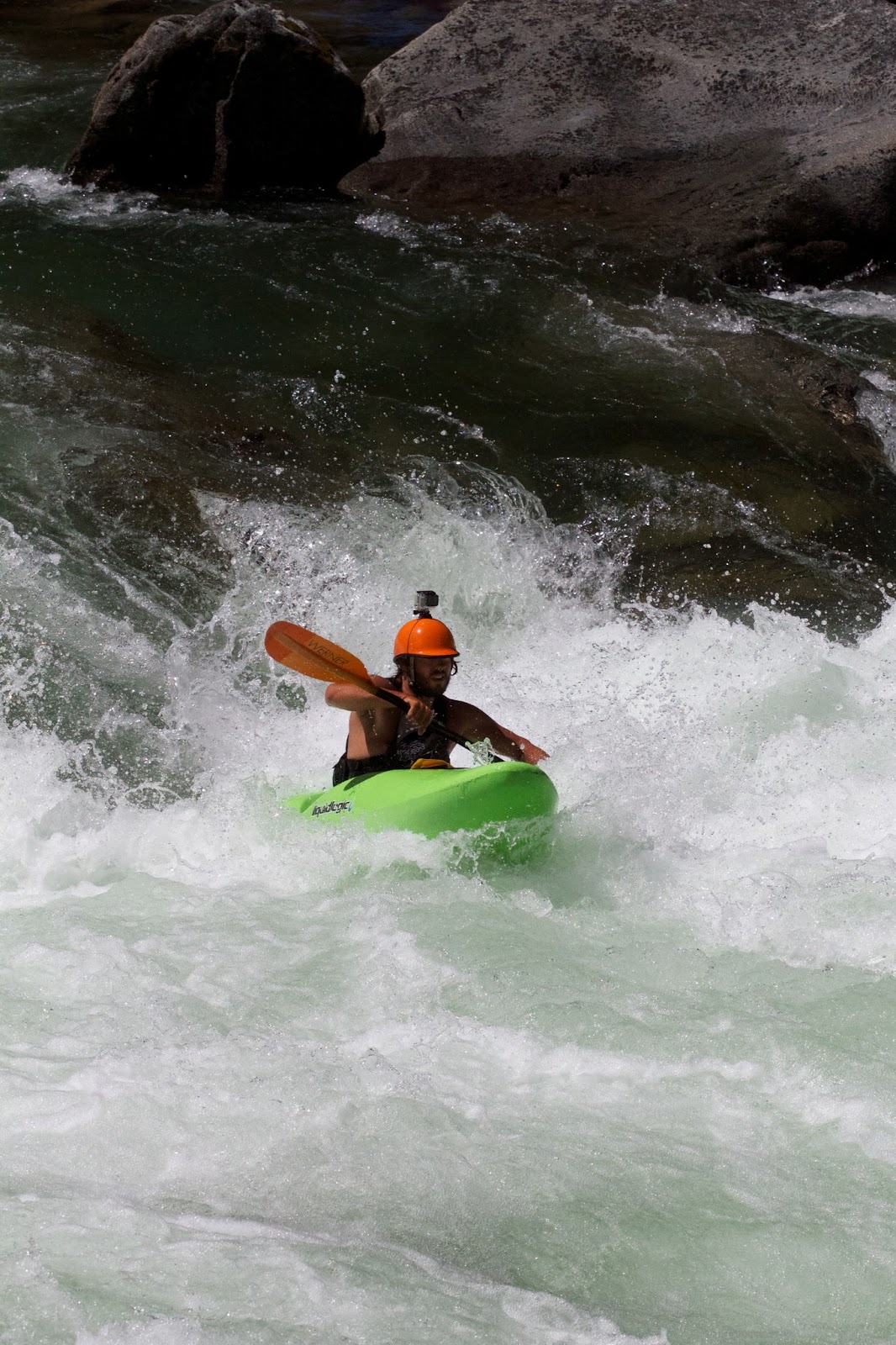
Upper Rio Lempa.
El Salvador
May 31 & June 1, 2014
After my recent run on the Upper Rio Lempa, Central America
paddling expert Greg Schwendinger of MayanWhitewater.com (MW) informed me mine
was the first run down this river since his last descent in 2003.
That led me to ask how such a quality canyon could go unseen
by kayakers for more than a decade.
Several things combine to make this one difficult to tackle.
Unfortunately for my visit, all the cards were stacked up in my contra. I think
I redefined “off-the couch.” While I’m active, surf daily, and take my boat out
into the ocean every so often, I hadn’t paddled on a river since July 2013 when
I left my beloved state of Washington for surfing and a business venture in El
Salvador.
It wasn’t long before I pined for the river.
Having Washington paddlers like John Ehlinger and Brad Xanthopoulos visit me in
the tropics reminded me that I can’t hide out down here forever. Not only did
Brad show up in El Salvador with a suitcase full of microbrew, but he also helped
me weld my cracked Nomad with the quality welding strips Jeremy Bisson donated
before I crossed into Mexico last year. With a welded boat, an impending rainy
season, and beta from the MW site, my eyes focused on two particular runs:
1 - Rio Jiboa
2 – Upper Rio Lempa
My main interest in the Jiboa run (other than its quality
confirmed by Greg Schwendinger and Rocky Contos’ descent in 2010) is its
proximity to my house. However, the
level on the Jiboa seemed less cooperative while the Lempa sat just above what Greg described as a good flow. Lempa Time.
Mayan Whitewater's river description of Upper Rio Lempa:
http://mayanwhitewater.com/rivers/salvador/lempaupper.html
A lot has changed in El Salvador since 2003. Along with
increasingly crowded surf lineups, there is also a sick new highway that makes
the Upper Lempa takeout a breeze.
After reviewing MW’s listing , I decided that a more
practical shuttle route was available. Considering that I had never run ANY of
the well described sections of Lempa, I decided to tackle the entire 26km
stretch starting from the Citalá bridge at the border with Honduras all the way
down to the “new” takeout at the bridge in the town of Santa Rosa Guachipilín.
The existing shuttle suggested several hours of driving on rugged roads. I
decided I would rather spend extra time on the river versus in the car. Using Google
earth, it appeared I was only adding ~6km (3.7 miles) to the run.
 |
| Shuttle Route for Upper Lempa |
I might be the only whitewater paddler in El Salvador, so unfortunately
this descent included just one kayak. I took the day off on Friday to ensure I
had everything ready for the trip. I adjusted outfitting, corralled my dry bags
& carabiners, and put together a list for the hardware and grocery
stores. I arrived at my girlfriend’s
place on Friday evening and we took it easy so I could rest up for the big
weekend.
Saturday morning was ominous in San Salvador. Steady, heavy
rain blitzed the city from all angles. The weather report I had seen for the region
of El Salvador where I would paddle looked favorable, so I remained optimistic.
After the 1.5-hour drive to the takeout, the report was confirmed. Blue skies
and a nice, low first-time level. The gauge read just under 1.1 meters on May
31, but the river at the takeout looked low, and scrapy. After confirming our
take-out meeting spot was legit, we then left in the same vehicle for the put-in.
20 minutes past the famous alpine town “La Palma” sits the Citalá bridge. I was
disappointed to find that what absolutely HAD to be Rio Lempa bore no sign on
the bridge to confirm. I didn’t want to risk putting onto some nearby tributary
(levels were low and scrapy at the put-in too) so I asked a few locals if
indeed I was gazing into Rio Lempa’s waters. “Cabal, ese es Rio Lempa”. 3
people told me I was in the right place. The last person told me that I could
cross into Honduras without waiting in line. Boom. that was the confirmation I
needed.
 |
| Early on Lempa Flats. Just below Citalá bridge. |
Eugenia left me at the put-in at 2:30 pm and I started my
descent. According to MW, I had 1.5 hours of class III paddling before getting
to the “Ruta del Jaguar” class IV section. Not taking any chances, early on I scouted
2-3 times. The first rapid, a distinct boulder garden, required scouting to
pick a clean route through its channels. That one was manky and shallow. I then
continued down for approximately 1 hour until getting to second scout. I
couldn’t tell from upstream, but there was a very cool passage through the
river right side, cuddled against the canyon wall. After paddling (err
scraping) down the center to left line, I noted from downstream that river
right was good to go.
 |
| Second Scout |
Soon after second scout came third scout, which appeared to
be the rapid MW discussed as having the “blind left curve”. On hard river left
sat a nasty undercut shoulder dislocating fanglike beast. That side was quickly
identified as undesirable. I had to spend several minutes here getting a clear view
of river right and what lay after the “blind left curve”. The line was center
to hard river right, and then around the blind curve. Opting instead for the 90
degree left turn, I later saw that I missed a nice boof, up against the large
boulder 10 feet downstream of the turn. This rapid was fun, class IV, and not too
pushy.
 |
| Third Scout |
 |
| Some Beta on Third Scout |
One drop down from third scout came “Left Boof”. This rapid channeled
river left onto a sweet launching pad into a clean pool within constricted rock
formations. The center line on this rapid looked manky.
 |
| Left Boof |
From there I continued downstream in uninterrupted fashion
for approximately 2 hours. There were maybe 2 scouts between “Left Boof” and
where I camped for the night, still above the harder canyon section. Both
scouts I encountered after “Left Boof” turned out to be clean, simple, good-to-go
Class III+ or IV- rapids, but with limited visibility from upstream.
 |
| Lempa Rock Formations |
 |
| View from Downstream on river left after scouting. There was limited visibility upstream on this one. Boat scoutable. |
 |
| This one was simple but should be scouted. There are undercut rocks on river right. Stay center. |
I passed a few decent looking spots to camp, but nothing
really jumped out at me. I wanted to get as far down the canyon as possible to
ensure I had enough light the following day.
Without doubt, I started my descent on Saturday too late. We lost time
on Saturday with our insurance stop at the takeout to make sure we had an
agreed upon meeting point, finding the put-in, and we just left home too late.
Typical.
I had enough light after making camp to forge a rain shelter,
organize gear, and get a spread ready. I
used my paddle to shovel nearby sand and create a flatter sleeping area under
the tarp. Dinner consisted of pre-cooked chicken sausage, an apple, cheese,
water, an orange, and a PBH (Peanut Butter & Honey).
Sure enough, after a day of bluebird skies and 4 hours in a
kayak where a splash of water was no detriment, it began to rain. It was light
but somewhat steady. Enough that being outside the rain shelter was
uncomfortable. With dry clothes on, I wasn’t cold. I had a thin rain shell
jacket to keep me dry but avoid getting hot. My rain shelter was pretty close
to the ground and uncomfortable for anything but lying down. Using my boat as a
backrest, I ate dinner in the rain-free zone and it became completely dark just
before 7:00 pm. I hadn’t worked hard enough to fall asleep that early. Fortunately
the rain stopped. Safety meeting. I puttered around the campsite for a few
hours, checking out the awesome rocks near the shoreline and was alerted by the
presence of two large spiders whose eyes blazed with the peripheral glow of my
headlamp.
It started raining again around mid-night, after I had
fallen asleep. My rain shelter was in the flattest area of the campsite, but it
certainly wasn’t the widest. A large rock wall angled around 30 degrees created
one extreme of my sleeping area while the roots from a large nearby tree marked
the other. Rain splashed off the side of the rock like faint mist that was just
damp enough to irritate me. I changed positions to place my head at the
opposite end of the shelter. That side
was getting splashed a little now too due to the wind, but I was wearing my
hooded rain shell and that side appeared better than the opposite end. As the
wind fluxed, I restlessly attempted to sleep comfortably, all the while kicking
up grits of sand onto my therma-rest. I forgot to bring a ground cover. Typical. I remember saying to my self
repeatedly that “it could be so much worse”, which was true. I was dry with the
exception of a minor dampness either near the top of my head or my feet. If I
wouldn’t move around, I could keep sand off my sleeping pad. But it was hard to
sleep. I thought about the potential of the river level spiking,. The rain was
still relatively light. I made a few trips outside of the rain shelter to
adjust its angle and allow less rain to enter.
I dosed off for a few hours before waking again. The rain was
harder now, and the wind was vigorous. Although I was dry and warm enough,
sleeping became a significant challenge. Then I heard a low rumble that became
louder, followed by the obvious sound of increased water flow at the nearby
stream feeding into Lempa. Headlamp on. Shoes on. WTF. I responded quickly and
eyed a location to move boating gear. Water from that stream came within 15
feet of where I was sleeping before the sound grew weaker and the water level
ebbed. The scare lasted close to 10 minutes. Miniature flash-flood.
 |
| Rough Night |
At cockcrow the river level was notably pumping. The
place where I had pulled my boat out of the river the night before was now
completely underwater, along with the 3-foot rock that was sitting atop that
bank. I remember not panicking, but immediately shifted from thoughts of an
awesome Sunday to a “game-on” mentality. First task was getting sleep. The rain
had completely stopped, I was still dry, and after a rough night I was able to
fall asleep and remain that way for nearly 3 hours.
My original plan was to wake up early on Sunday, and start
my descent as soon as possible. It was 9 by the time I had my gear together,
food ingested, and was ready to start. Before gearing up, my teeth chattered, but
I wasn’t cold.
 |
| Increased Flow on Day-Two. Citalá Gauge - 1.4m. |
The first hour of paddling was awesome. The river remained
wide and the flow was powerful. In my head I repeated the advice from Mayan Whitewater:
“Crux Move: patient scouting”.
Remember when I mentioned redefining “off the couch”? Let’s
go ahead and review this list. I hadn’t been on a river for 10 months, I was
descending a new river solo, in a class V canyon, the flow was significantly
higher than recommendable, l was low on drinking water, tired as fuck, in a loaded
down boat.
I scouted. And I scouted patiently. No chances. I found MW’s
overall description to be accurate: “The upper Lempa is classic Central American
class V creeking in a steep secluded canyon. The scenery reminds me of
California. The pool-drop rapids are varied and high-quality, with some drops
getting quite big. When boat-scouting, I recommend doing so extra-defensively
since I found several rapids drawing me in a little too close for comfort. The
river provides some challenges to everyone, yet when it
gets too challenging there is always a portage option over the
boulders…. the drops seemed to get bigger and trickier towards the end of the
canyon.”
I had to portage 3 times, and 2 of the three were extremely
difficult and tiring because of the weight of my boat. On the first portage, I
scouted from the wrong side of the river. I had already hiked all the way downstream
and back before realizing that I would not run the rapid. and needed to first
get to the other side.
The rapid I just described is the one pictured in the MW listing.
Here is a look at the same spot on June 1, 2014:
 |
| Crux Canyon |
 |
| Another significant rapid. View from the Scout |
 |
| View from the boat |
 |
| Lunch Hole |
 |
| Crux Move in "a long road to a big hole" right below this hole all the current feeds into the big one, alongside the large rock 40 feet downstream on river right. No margin for error in this hole above it. There was a line to the left of this covered rock to the left of my bow in the picture. But it was hard to make. I tried and missed. |
 |
| More cool rock formations from Day 1 |
 |
| This one looks burly in the picture but it was the best rapid on the run. It has a straightforward toungue right down the middle, its clean and it went smoothly. You just have to get past this entry wave first.. |
Just as described in MW, the rapids were more challenging
closer to the end of the run. Since I didn’t know where the end of the run was,
I maintained absolute focus for each horizon line, each ledge, and each river bend.
I took water at regular intervals, and had an orange at lunch. I came to a
rapid that I later described in photos as “A long road to a big hole”. This one
was a clean big-water style rapid that would be an absolute blast if not for a
massive hole on far river right below the crux of the drop. Unfortunately all
the water feeds into that hole and feeds into it quickly. I decided to run the rapid, and in real-life
it was as just as hard to get left of the hole as it looked while scouting. In
the video clip, you can see me skirting just left at ~ 01:15.
There were several significant rapids below there and the
final rapid of the canyon, which was the steepest of the entire run. After portaging
it, I was able to get a clearer picture of the canyon walls at the bottom of
the drop and now consider it to be runnable even at the high flow.
 |
| Last Rapid in the Canyon Section |
Immediately after that last drop, the scenery changed and I
appeared to have reached the end of Lempa’s most challenging section,
unscathed. My hopes were confirmed when I saw typical El Salvadoran street dogs
running along the banks of the river barking at me. I passed a couple fishermen
bearing looks of disbelief and saw people herding cows on the hillside.
The fun continued in Class III+ to IV- fashion all the way
to the takeout. I passed several quality
surf waves and one with large eddy service. Pleasantly surprised, it only took
me around 30 minutes to get from the end of the canyon section to the bridge
where Eugenia was waiting for me. Along
the way there was a hammock bridge with a small store on river right. You
wouldn’t know it was a store, but if you have my luck, you’ll see people down by
the water and they can point you in the right direction. I only had a 10 dollar bill with me, and
without change the owner donated two small plastic bags of Agua Cristal to my
cause (In El Salvador we drink out of sacks). I guzzled them down and thanked the
owner for her kindness. She asked me why the school buses with rafts never came
anymore.
At this point morale was at an all-time high for the
trip. I had survived the canyon, I was
hydrated, and according to the locals I had not far to go for the bridge at
Santa Rosa Guachipilín. They told me that from their small village of Caserío
Lempa it was a 30-minute drive to the take-out bridge. A few fun surf waves
down, I caught sight of a cell-phone tower and sent a text to Eugenia that I
made it out safely. I celebrated with a safety meeting.
The take-out bridge at Santa Rosa Guachipilín was 2-3 river
bends down from the view of that cell-phone tower, and it marked the end of my
trip.
In a show of excellent character, the car had 3 cold
beers waiting for me, and I got to sip them on the way home while Eugenia
drove. I was only 15 minutes late for our scheduled meeting time.
Now that’s boom.
Adrian Wigston, reporting for Fluid: As a Lifestyle, from El
Salvador.